Loading...
Results for Maps and Drawings ( 7 products )

1:4000 Base Map - Sanitary
FreeThis set of utility files shows information for Sanitary Sewer System infrastructure within the city of Calgary. These files are updated annually and are a digital representation of the pages from the annual publication of the “1:4000 Section Map books” that are provided in hardcopy. The property linework is not included in these files but is available through the LSF and OPF product. Each PDF file depicts one legal section of the city of Calgary, overlaid with the Sanitary Sewer System infrastructure information for that section. The applicable legends, conversion tables, and any other relevant information required to understand these maps are available for download at no cost.
1:4000 Base Map - Storm
FreeThis set of utility files shows information for Storm Sewer System infrastructure within the city of Calgary. These files are updated annually and are a digital representation of the pages from the annual publication of the “1:4000 Section Map books” that are provided in hardcopy. The property linework is not included in these files but is available through the LSF and OPF product. Each PDF file depicts one legal section of the city of Calgary, overlaid with the Storm Sewer System infrastructure information for that section. The applicable legends, conversion tables, and any other relevant information required to understand these maps are available for download at no cost.
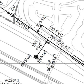
1:4000 Base Map – Water
FreeThis set of utility files shows information for Water System infrastructure within the city of Calgary. These files are updated annually, and are a digital representation of the pages from the annual publication of the “1:4000 Section Map books” that are provided in hardcopy. The property linework is not included in these files but is available through the LSF and OPF product. Each PDF file depicts one legal section of the City of Calgary, overlaid with the Water infrastructure information for that section. The applicable legends, conversion tables, and any other relevant information required to understand these maps are available for download at no cost.
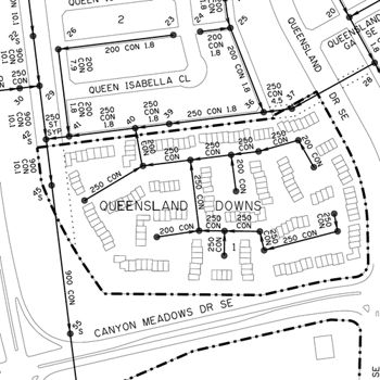
Community Address Maps by Name – PDF
FreeThe PDF map includes addresses, land use districts, streets and street names, buildings, parks and schools.
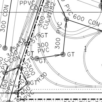
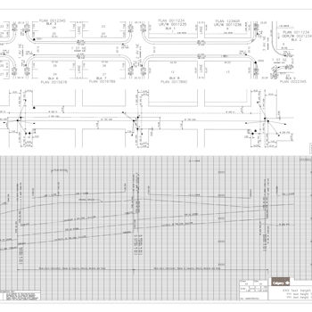
Electronic Block Profile - TIFF
FreeA Block Profile is a detailed engineering drawing of a record containing features within a public right-of-way. The Block Profile Plan is divided into three parts: two Plan Views and one Profile, with the exceptions of major roads and large right-of-ways. 1. The Top Plan View shows surface features, legal descriptions, and bordering property data. 2. The Utility Plan View shows utility locations within the public right-of-way and related data. 3. The Profile shows public right-of-way and utility grades and related data.
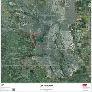
Calgary Air Photo Map - PDF
FreeThis Aerial Orthophoto map of Calgary was created from our 2024 DAS aerial survey and is 42”x56” in size. This is a map in .PDF format that can be used for wall map printing.
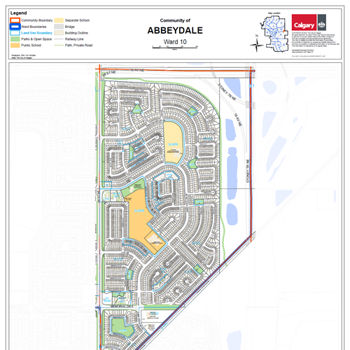
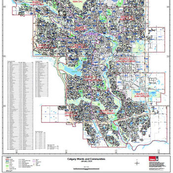
Community & Wards – PDF
FreeThis city-wide map shows all community and ward boundaries along with associated labels and codes. It also displays major and collector roads, road annotations, LRT tracks, stations, hydrography, parks, golf courses and transportation utility corridors. This map is in .PDF format and is 42”x58” in size. This .PDF can later be used for wall map printing.