Loading...
Results for Aerial Imagery ( 7 products )

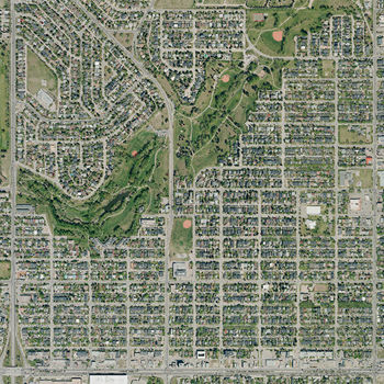
Orthophotos 2018
FreeAn orthophoto is an aerial photograph, geo-referenced and geometrically corrected to have a uniform scale, that can be situated accurately on a digital map. They are available for immediate download with digital licensing. The orthophoto may be used for referencing but may not be distributed or republished without permission. These orthophotos cover the entire City of Calgary with at least a 2 km buffer beyond the city's boundary. As a result, some sections beyond the city limits may be incomplete.
Orthophotos 2019
FreeAn orthophoto is an aerial photograph, geo-referenced and geometrically corrected to have a uniform scale, that can be situated accurately on a digital map. They are available for immediate download with digital licensing. The orthophoto may be used for referencing but may not be distributed or republished without permission. These orthophotos cover the entire City of Calgary with at least a 2 km buffer beyond the city's boundary. As a result, some sections beyond the city limits may be incomplete.
Orthophotos 2020
FreeAn orthophoto is an aerial photograph, geo-referenced and geometrically corrected to have a uniform scale, that can be situated accurately on a digital map. They are available for immediate download with digital licensing. The orthophoto may be used for referencing, but may not be distributed or republished without permission. These orthophotos cover the entire City of Calgary with at least a 2 km buffer beyond the city's boundary. As a result, some sections beyond the city limits may be incomplete.
Orthophotos 2021
FreeAn orthophoto is an aerial photograph, geo-referenced and geometrically corrected to have a uniform scale, that can be situated accurately on a digital map. They are available for immediate download with digital licensing. The orthophoto may be used for referencing, but may not be distributed or republished without permission. These orthophotos cover the entire City of Calgary with at least a 2 km buffer beyond the city's boundary. As a result, some sections beyond the city limits may be incomplete.
Orthophotos 2022
FreeAn orthophoto is an aerial photograph, geo-referenced and geometrically corrected to have a uniform scale, that can be situated accurately on a digital map. They are available for immediate download with digital licensing. The orthophoto may be used for referencing, but may not be distributed or republished without permission. These orthophotos cover the entire City of Calgary with at least a 2 km buffer beyond the city's boundary. As a result, some sections beyond the city limits may be incomplete.
Orthophotos 2023
FreeAn orthophoto is an aerial photograph, geo-referenced and geometrically corrected to have a uniform scale, that can be situated accurately on a digital map. They are available for immediate download with digital licensing. The orthophoto may be used for referencing, but may not be distributed or republished without permission. These orthophotos cover the entire City of Calgary with at least a 2 km buffer beyond the city's boundary. As a result, some sections beyond the city limits may be incomplete.
Orthophotos 2024
FreeAn orthophoto is an aerial photograph, geo-referenced and geometrically corrected to have a uniform scale, that can be situated accurately on a digital map. They are available for immediate download with digital licensing. The orthophoto may be used for referencing, but may not be distributed or republished without permission. These orthophotos cover the entire City of Calgary with at least a 2 km buffer beyond the city's boundary. As a result, some sections beyond the city limits may be incomplete.